|
ANTRIM ROUND TOWER
Map Reference: J154878
A monastery may have existed at Antrim in the early 7th century but the Round Tower is the only survival of an early foundation.
It is 28m high and is complete with conical cap. About 1820 it was struck by lightning, after which it was repointed and the
cap reset. The square-headed doorway is about 2.5m above ground level and is about 1.5m high and 60cm wide. The large boulder
nearby is called the "Witchs Stone" and contains a small and a large bullaun.

ARMOY ROUND TOWER
Map Reference: D078332
St Olcan, a disciple of St Patrick, is said to have founded a monastery at Armoy, but there is nothing known about it. In
1843 the Round tower was repaired for use as a belfry and fitted with a wooden roof. It now stands about 11m high and has
a very narrow doorway about 1.5m above present ground level. It is reckoned to be the narrowest Round Tower doorway in Ireland
and is about 50cm wide at the bottom. It is capped by a single stone with a raised moulding. There are no other openings in
the tower. The church was rebuilt in 1820 and enlarged in 1846. The memorials in the churchyard are mainly 19th and 20th century
with some 18th century stones.

DALWAY'S BAWN, BALLYHILL
Map Reference: J443914
This is a very fine example of an early 17th century planter's bawn. It was built about 1609 by John Dalway. It was a rectangular
bawn with four round flanking towers, three of which still exist. The inner faces of the towers are square with crow-stepped
gables.There would have been a dwelling house in the middle but this is now gone.

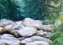
BALLYLUMFORD MEGALITHIC TOMB
Map Reference: D431016
This small megalithic tomb is known as the Druids Altar. A large capstone is supported by four uprights and another stone
lies within the chamber. It may be a small portal tomb or a passage tomb denuded of its cairn.

DOOEY'S CAIRN, BALLYMACALDRACK
Map Reference: D021182
This court tomb is set within a trapezoidal cairn about 21m long by about 14m wide. The U-shaped forecourt at the SW end leads
to a single burial chamber. Beyond this is a long cremation passage with three circular pits. Charcoal recovered from excavations
may be dated to between 3000 and 2500 BC. Pottery recovered from the burial chamber has a similar date. The arms of the court
are built with the post-and-panel technique, found at Annaghmare, Co Armagh and Creggandevesky, Co Tyrone.

BALLYWEE RATH & SOUTERRAINS
Map Reference: J218899
This site was excavated in 1974 prior to its threatened removal as part of a farm improvement scheme. A series of curved earthen
banks bounds an oval area about 90m by 50m. Within this area were found three souterrains and the foundations of at least
six buildings. Two of the souterrains had an entrance within a building and the other was isolated. The site has been preserved
and it is hoped that it will be open soon to the public.

BONAMARGY FRIARY
Map Reference: D128408
Bonamargy Friary is approached through the ruin of a two-storey gatehouse which has a fireplace in the upper storey. The rectangular
church has a north and south range of buildings. The north range has a series of fine vaulted rooms at the lower storey. The
upper storey can be reached by a good stone stairway but is ruinous. The site of the cloister can be clearly seen at the angle
of the church and the north range but none of the cloister buildings remain. The large east window of the church is ruinous
but features fine masks and decorated label stops on the outside. There are some other decorated stones in the east gable.
Inside the west wall of the church is a small holed cross which marks the grave of Julia MacQuillan, the Black Nun. She prayed
that, after her death, people would walk over her grave. It is a ring-headed cross with stumpy arms. The pointed south doorway
is set within a fine round-headed recess. The upper storey of the south range has some fine mullioned windows. The lower storey
contains a burial vault. In the south wall of the nave is a tomb-niche of 1630. The other memorials within the church are
mainly late 18th century. The churchyard has a mixture of ancient and modern stones.

CARRICKFERGUS CASTLE
Map Reference:J415873
This castle was built by John de Courcy at the end of the 12th century. The inner ward with the keep was begun about 1178
and the rest was added during the first half of the 13th century. It was besieged by King John in 1210 and by Edward Bruce
in 1315. It continued in military use until 1928.

CRAIGS DOLMEN
Map Reference: C973172
This small megalithic tomb is similar in some respects to Ballylumford Dolmen. Seven uprights support a large flat capstone.
The capstone was shattered in 1976 by lightning. It was repaired in 1985 and excavation at that time showed that the chamber
was the remains of a passage tomb. It was probably built before 2000 BC but was re-used for burial in the Bronze Age.

THE BROAD STONE, CRAIGS
Map Reference: C979176
At first glance the Broad Stone has the appearance of a tripod dolmen. Closer inspection shows that it is a three-chambered
court-grave. The large capstone is about 2m square and 30cm thick. The back supporting stone is not in the original position
since it blocks the gap between the first and second chambers. Some court stones are in position and there is a large amount
of cairn material.

DOAGH HOLESTONE
Map Reference: J242907
The Doagh Holestone is a flat pillar tapering to a point and less than 1.5m high. It is pierced by a hole about 8cm diameter
and splaying out on both sides to about twice that size. The date and original function of the Holestone is unclear. It may
date from pre-Christian times but, unlike two other perforated stones in Co Antrim it has not been 'christianised'. The Holestone
was used at one time to chain up crimunals. It has also been used as a betrothal stone, with the happy couple plighting their
troth by clasping hands through the stone. Such betrothal ceremonies must have been common in the days of slow travel and
shortage of clergy or civic officers. To avoid illegitimacy in children pre-marriage ceremonies were often performed according
to local custom; the bond was completed later when a priest or registrar was available. Expressions such as 'jumping the broomstick',
'living over the brush' or 'tying the knot' may come from such ceremonies.

DUNLUCE CASTLE
Map Reference:C904414
This castle is spectacularly situated on a rocky headland. It is separated from the mainland by a deep ditch, now spanned
by a modern bridge. The earliest parts date from the 14th century but most of the castle dates from the 16th century. There
is a twin-towered gatehouse with Scottish corbelled turrets. There are remains of several round flanking towers. The rock
on which the castle stands is penetrated by a large cave.

DUNSEVERICK CASTLE
Map Reference: C988445
This tiny fragment of a castle stands near the S edge of a pear-shaped rock. It is probably part of the gatehouse of a late
16th century castle built by the O'Cahans, who held it under the MacQuillans and later the MacDonnells, Earls of Antrim. The
castle was probably destroyed by the Parliamentarians, led by Captain Venables, in the middle of the 17th century. The site
is named after Sobhairce, who lived in the middle of the 2nd millennium BC. Dunseverick was at the northern end of one of
the five great roads which radiated from Tara.

LAYD CHURCH
Map Reference: D245289
Layd Church is a rectangular building with a two-storey tower at the west end. The upper storey is fragmentary but there is
a very fine vault above the ground floor. There are very good traces of wicker centering. There is a doorway in the south
wall of the church and a square-headed doorway leads from the church to the tower. Above this is a rectangular opening. This
feature is repeated at the window above the doorway. There is some restoration work in progress. In the south wall of the
church is a fragmentary piscina and the east window seem to have been small. The north and south walls project beyond the
line of the east gable in the manner of antae. Just outside the tower is a fine 19th century cross. It is a good example of
Celtic Revival work and features some good interlacing as well as picture panels. Close to the entrance to the churchyard
is a sandstone pillar with a round expanded top. This is perforated. This may be of great antiquity but has been re-used as
a more recent memorial. There are some 18th century memorials near the church.

MAGHERABOY MEGALITHIC TOMB
Map Reference: D037438
The remains of this megalithic tomb comprise a circular cairn, with a kerb about 10m diameter. Only the stones of the burial
chamber and the kerb remain. From NE-SE, the cairn is truncated by a modern stone wall & no visible trace survives on
the E side of the wall. The chamber is orientated NW-SE & consists of 3 stones supporting a massive capstone, 2m long.
The SW sidestone fits into a groove in the capstone. The chamber is approximately 1m square.

|